|
|
| Nordchile
- Von Arica bis Los Vilos: |
| Leider
hatten wir bisher noch nicht Gelegenheit, diese Seite ins
Deutsche zu übersetzen. Bei eventuellen Fragen können
Sie sich aber an uns wenden. |
| |
|
Nº
1 Lauca y Surire
68
x 100 / 27 x 15 cms.
Ch$
6.000 |
Side
1: From Visviri and Arica to to Pisagua and Chusmiza.
Side
2: From Huara to Tocopilla and Chuquicamata
Road
Map, 1:400.000
 |
|
Nº
2 San Pedro de Atacama y
Salar de Maricunga
68
x 100 / 27 x 15 cms.
Ch$
6.000 |
Side
1: From Chuquicamata and Oficina María Elena
to Cerro Llullaillaco.
Side
2: From Paposo to Caldera and Ojos del Salado
Road
Map, 1:400.000
|
|
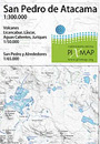
San
Pedro de Atacama
Spanish, English, German
69
x 88 / 17,5 x 13 cms.
on stone paper
Ch$
7.500 |
Side
1: Surroundings of the Atacama Saltlake, from the volcanoes
San Pedro and San Pablo in the north until Tilomonte/Sico
Pass in the south. Includes Calama, Chuquicamata, Jama
Pass and the toursitic attractions of the Tatio Geysers,
Licancabur volcano, Tara saltlake, lagoons Miscanti
and Chaxa, etc. - 1:350.000
Side 2: Surroundings of San Pedro, Moon and Death Valleys,
Tulor, Quitor, Catarpe, and the other ayllus, 1.50.000.
San Pedro city map with listing of touristic adresses.
|
|
San
Pedro de Atacama
(Chile)
72
x 55 / 19,5 x 12,5 cms.
Ch$
7.000 |
Side
1: Surroundings of San Pedro de Atacama, from Chiu Chiu
and Laguna Colorada (Bolivia) to Paso de Sico, including
Geisers del Tatio, Valle de la Luna, Salar de Atacama
and the lagoons of Tara, Miscanti and Miñiques.
Road map, orientation, 1:300.000
Side 2: Inserts with details of Quebrada San Pedro,
Lascar volcano and Licancabur volcano.
Trekking, 1:65.000 y 1:50.000
|
|
Nº
3 Copiapó Elqui
68
x 100 / 27 x 15 cms.
Ch$
6.000 |
Side
1: From Copiapó to La Higuera / Cuesta Buenos
Aires
Side
2: From Cuesta Pajonales / Quebrada Honda to Los Vilos.
Road
Map, 1:400.000
|
|
Rapa
Nui
Isla de Pascua / Easter Island
Español, english, deutsch
55 x 60 / 19 x 12 cms.
Ch$
5.500 |
Side
1: Entire Easter Island with all roads and trails, touristic
highlights, archeological sites, etc.
Scale 1:50.000, coordenates in Lat/Long
Side 2: City map of Hanga Roa with tourist services,
lodging, restaurants, etc. Scale 1:7.000
|
| |
|
|
|
| |
|