|
|
| Südliches
Zentralchile - Von
Chillán bis Puerto Montt: |
| Leider
hatten wir bisher noch nicht Gelegenheit, diese Seite ins
Deutsche zu übersetzen. Bei eventuellen Fragen können
Sie sich aber an uns wenden. |
|
|
Nº
5 Maule, Biobío y Araucanía
68
x 100 / 27 x 15 cms.
Ch$
6.000 |
Side 1: From Rengo and Pichilemu to Bulnes and Talcahuano.
Side
2: From Bulnes and Talcahuano to Lago Caburgua.
Road
Map, 1:400.000
 |
|
Nevados
de Chillán
Spanish, English, German
70
x 75 / 17,5 x 13 cms.
Ch$
5.500 |
Side
1: From Recinto to the mountain range Nevados de Chillán
and National Reserve Ñuble (Los Peucos, Valle
Hermoso); valleys of Las Trancas, Shangri-La and Aguas
Calientes
1:50.000, coordinates in Lat/Long (one-minute-grid)
Side 2: Details of Las Trancas-area (Scale 1:12.500);
listing of touristic adresses, native flora.
|
|
Volcán
Antuco /
Sierra Velluda
30
x 42 / 15 x 12 cms.
Ch$
8.500 |
Antuco volcano with the ascent route from the ski center (Ruta Normal), from Campamento Los Barros and Ruta Este from Laguna Laja. Route to the pass and the northern summit of the Sierra Velluda. Trails to Meseta del Toro, Anfiteatro and Saltos El Torbellino and Las Chilcas. Campsites and refuges.
Shows coordinates of important points, distances on trails.
Mountaineering, Cross-country skiing, 1:35,000, UTM coordinates, equidistance contour lines 25 m.
|
|
Antuco
Spanish, English, German
74
x 70 / 18,5
x 14 cms.
Ch$
5.500 |
Covers all the highlights of the Laguna de Laja national
park, from Abanico until Los Barros, including Antuco
volcano and the Sierra Velluda, shows many hiking trails
and ascent routes.
Trekking
and mountaneering, 1:30.000, coordenates in Lat/Long
y UTM.
|
|
Volcán Callaqui
30
x 42 / 15 x 12 cms.
Ch$
8.500 |
Normal Route along Estero Epún - El Turbio, Northwest Route, Western Route from Chipanco, Southern Route from the Malla River. Camps and sites with drinking water.
Shows coordinates of important points, distances on trails
Mountaineering, Cross-country skiing, 1:30,000, UTM coordinates, equidistance contour lines 25 m.
|
|
Lonquimay-Conguillío
Spanish, English, German
100
x 70 / 17 x 13 cms.
on stone paper
Ch$
7.500 |
Side
1: From PN Tolhuaca to Nevados de Sollipulli, including
RN Las Nalcas, RN Malalcahuello, PN Conguillío
and RN China Muerta. With volcanoes Tolhuaca, Lonquimay,
Llaima, Sierra Nevada and the lakes Icalma and Gualletué.
Hiking trails, camp sites, accommodation, etc.
Trekking and road map, 1:100.000, coordenates in UTM
and Lat/Long.
Side 2: Detail maps 1:50.000 of the areas around Lonquimay
volcano and PN Conguillío / Llaima with hiking
trails and ascent routes.
|
|
Volcán
Tolhuaca
30
x 42 / 15 x 12 cms.
Ch$
8.500 |
Tolhuaca volcano with normal route from Laguna Blanca, nearby trails and camping areas. Cordón Los Dedos, Cajón La Holandesa. Lagunas Blanca and Verde.
Shows coordinates of important points, distances on trails
Mountaineering, Cross-country skiing, 1:30,000, UTM coordinates, equidistance contour lines 25 m.
|
|
Volcán
Lonquimay
30
x 42 / 15 x 12 cms.
Ch$
8.500 |
Ascent route to Loquimay volcano from the Corralco ski center and from Paso Lolco. Hiking trails, Cráter Navidad and Escorial Lonquimay. Cordillera Las Mellizas, Sierra de los Colorados. Cuesta Las Raíces and Centro Invernal Los Arenales.
Shows coordinates of important points, distances on trails
Mountaineering, Cross-country skiing, 1:30,000, UTM coordinates, equidistance contour lines 25 m.
 |
|
Malalcahuello
54
x 60 / 19 x 13 cms.
Ch$
5.000 |
Valley of Cautín river between Manzanar and Malalacahuello. Cuesta Las Raíces and the ski centers Corralco and Los Arenales. Ascent routes to the volcanoes Lonquimay and Tolhuaca. Hiking trails Travesía, Colorado, Coloradito, Río Cautín, Río Mellizas, Cráter Navidad, Laguna Totora. Campsites, refuges and viewpoints.
Shows coordinates of important point.
Hiking, 1:50,000, UTM coordinates, equidistance contour lines 25 m.
|
|
Conguillío
Nevados de Sollipulli
65
x 80 / 19 x 13 cms.
Ch$
11.900 |
Routes to Llaima volcano from the ski center Araucarias, from de refuges Nevados de Vilcún (formerly Paraguas) and from Captrén and Laguna Verde. Ruta Travesía Sierra Nevada (Norte/Sur) with descent to Cajón de Río Blanco. Hiking trails Laguna Espejo, Carpinteros, Contrabandista, Sendero de Chile, Nevados de Sollipulli routes Norte and Sur, Laguna Cochor, Geysers de Alpehue. Refuges and campsites
Hiking, Mountaineering, 1:50,000, UTM coordinates, equidistance contour lines 25 m. |
|
Sierra
Nevada
30
x 42 / 15 x 12 cms.
Ch$
7.500 |
Ascent routes from Malalcahuello (Ruta Norte and Ruta Centinela), from Conguillío lake (Ruta Sierra Nevada Sur) and from Laguna Espejo. Route to Cajón del Río Blanco with the hot springs La Vaca and El Toro. Piedra El Sapo. Campsites, viewpoints and services at the Lago Conguillío area.
Mountaineering, Cross-country skiing, 1:30,000, UTM coordinates, equidistance contour lines 25 m.
|
|
Volcán
Llaima
30
x 42 / 15 x 12 cms.
Ch$
8.500 |
Llaima volcano with ascent routes from ski center Las Araucarias and from refuge Nevados de Vilcún (formerly Los Paraguas) and from Laguna Verde. Partially route from the north (Captrén).
Shows coordinates of important points, distances on trails
Mountaineering, Cross-country skiing, 1:30,000, UTM coordinates, equidistance contour lines 25 m.
|
|
Nevados
de Sollipulli
30
x 42 / 15 x 12 cms.
Ch$
7.500 |
Route to Cumbre Norte from Chufquén and to Cumbre Sur from Laguna Cochor, as well as the crossing of the glacier (only experts). Lakes Cochor and Ruminani. Lodge Nevados de Sollipulli, Curimeno pass.
Shows coordinates of important points, distances on trails
Mountaineering, Cross-country skiing, 1:30,000, UTM coordinates, equidistance contour lines 25 m.
|
|
Nº
6 Villarrica, Llanquihue y Chiloé
68
x 100 / 27 x 15 cms.
Ch$
6.000 |
Side
1: From Lago Villarrica to Puerto Montt.
Side
2: From Maullín and Puelo to La Junta.
Road
Map, 1:400.000
|
|
Villarrica
Traverse
Pucón - Volcanes Villarrica y Quetrupillán
(Chile)
60
x 42,5 / 21,5 x 12,5 cms.
Ch$
8.000 |
Side 1: Surrounding of Villlarica volcano, from Pucón
to Termas Vergara and Palguín valley. Trails
Challupén, Los Cráteres, Pichillancahue/Nevados,
Valle Turbio, Ruta Volcán and many more.
Side 2: Quetrupillán volcano from Palguín
Alto to Puesco and Curarrehue. Trails Venados, Avutarda,
Huililco, Quinquilil, ascent route to Quetrupillán,
etc.
Mountaineering, Trekking; 1:50.000, contour interval
is 25 m
UTM coordinates every 2500 meters.
|
|
Volcán
Villarrica
30
x 42 / 15 x 12 cms.
Ch$
8.500 |
Ascent route to the crater fom ski center Skipucon. Trails Challupén-Chinay (first part of the Villarrica Traverse), Mirador los Cráteres, Glaciar Voipir, Pichillancahue and Los Nevados.
Shows coordinates of important points, distances on trails
Mountaineering, Trekking, Cross-country skiing, 1:34,000, UTM coordinates, equidistance contour lines 25 m.
|
|
Volcán
Lanín
30
x 42 / 15 x 12 cms.
Ch$
8.500 |
Ascent routes Normal (Argentina) and Ruta Chilena. Refuges and campsites, International pass Mamuil Malal. Lagos Andinos trail with lakes Escondida, Huinfiuca and Plato; Momolluco trail.
Shows coordinates of important points, distances on trails
Mountaineering, Trekking, Cross-country skiing, 1:30,000, UTM coordinates, equidistance contour lines 25 m.
|
|
Huilo
Huilo
Spanish, English, German
90
x 68 / 17 x 11,5 cms.
on stone paper
Ch$
7.500 |
Side
1: Whole area of Huilo Huilo reserve, from Liquiñe
to Maihue lake, from Choshuenco to the border, including
Pirehueico lake and Mocho / Choshuenco volcano. many
trails for hikinh and trekking. Scale 1:75.000, UTM
and Lat/Long coordinates.
Side 2: Detail map of the central area of the reserve,
including the villages of Neltume and Puerto Fuy. Hotels,
Museum and other facilities of the complexo. Short trails
lake Salto Huilo Huilo, Puma, La Leona, Los Espiritus
and many more. Scale 1:20.000, UTM and Lat/Long coordinates.
|
|
Volcán
Mocho Choshuenco
30
x 42 / 15 x 12 cms.
Ch$
8.500 |
Ascent route from Reserva Nacional (near Enco) from the Conaf ranger station, passing Tumba del Buey to the peaks of Mocho and Choshuenco. Route from the ski center Bosque Nevado (Huilo Huilo reserve) to Mocho volcano. Campsites and refuges.
Shows coordinates of important points, distances on trails
Mountaineering, Cross-country skiing, 1:25,000, UTM coordinates, equidistance contour lines 25 m.
|
|
Puyehue
Spanish, English, German
87
x 55 / 17,5 x 13 cms.
on stone paper
Ch$
7.500 |
Side 1: Area between Carrán volcano and Las Gaviotas
on Rupanco lake. Including the mayor part of Puyehue
National Park with the volcanoes Puyehue, Cordon Caulle
and Casablanca. Hiking and trekking trails like Pampa
Frutilla, Las Gaviotas, Los Baños and many more.
Scala 1:75.000, UTM coordinates (2 kms-grid) and Lat/Long
Side 2: Detail maps of the areas Anticura (1:25.000)
and Antillanca (1:40.000) with their trails for short
hikes.
|
|
Volcán
Casablanca
30
x 42 / 15 x 12 cms.
Ch$
7.500 |
Casablanca volcano with ascent routes from the Raihuén crater and from the upper lift of the Antillanca ski center. Beginning of the trails towards Pampa Frutilla and Gaviotas. Trails Laguna Paraíso, Aguas Calientes and Cerro Hayque. Refuges and serveces of Antillanca ski center.
Shows coordinates of important points, distances on trails
Mountaineering, Cross-country skiing, 1:30,000, UTM coordinates, equidistance contour lines 25 m.
|
|
Volcán
Puntiagudo
30
x 42 / 15 x 12 cms.
Ch$
8.500 |
Ascent route from the norhern side, Puerto El Poncho / Lago Rupanco. Cordón Cenizos. Campsites.
Shows coordinates of important points, distances on trails
Mountaineering, Cross-country skiing, 1:30,000, UTM coordinates, equidistance contour lines 25 m.
|
|
Llanquihue
Spanish, English, German
56
x 85 / 17,5 x 13 cms.
on
stone paper
Ch$
7.500 |
Side
1: Area between Puerto Montt, Frutillar, Puerto octay
and Peulla, with the lakes Llanquihue and Todos los
Santos and the vulcanoes Osorno, Calbuco and Puntiagudo
1:150.000, coordinates in Lat/Long and UTM
Side 2: Detail maps of Vn. Calbuco, Vn. Osorno and the
area of the "Termas del Callao"-trekking with
the trails.
Scale 1:50.000, in Lat/Long and UTM
|
|
Volcán
Puntiagudo
30
x 42 / 15 x 12 cms.
Ch$
8.500 |
Ascent route from the norhern side, Puerto El Poncho / Lago Rupanco. Cordón Cenizos. Campsites.
Shows coordinates of important points, distances on trails
Mountaineering, Cross-country skiing, 1:30,000, UTM coordinates, equidistance contour lines 25 m.
|
|
Volcán
Osorno
30
x 42 / 15 x 12 cms.
Ch$
8.900 |
Normal ascent route from the ski center and northern route from Paso Desolación. Trails to Mirador Cráter Rojo and Cerro La Picada.
Shows coordinates of important points, distances on trails
Mountaineering, Cross-country skiing, 1:25,000, UTM coordinates, equidistance contour lines 25 m.
|
|
Volcán
Calbuco
30
x 42 / 15 x 12 cms.
Ch$
7.500 |
Ascent routes from the south (Río Blanco/Ruta Normal) and from the north (Río Tepu - La Isla). Campsites, refuges and viewpoints.
Shows coordinates of important points, distances on trails
Mountaineering, Cross-country skiing, 1:30,000, UTM coordinates, equidistance contour lines 25 m.
|
|
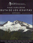
Ruta
de los Jesuitas
Paso Vuriloche
68
x 48 / 16 x 12 cms.
Ch$
7.500 |
Starting points of the trail from Ralún, Ensenada Cayutué and Brazo Río Blanco. Campsites, refuges and settler houses on the trail. Monte Tronador with ascent route from Refugio Meiling. Paso de las Nubes, Cerro Volcánico Este.
Shows coordinates of important points.
Hiking, Mountaineering, 1:50,000, UTM coordinates, equidistance contour lines 25 m
|
| |
|
|
|
| |
|