|
|
| Central
Chile
-
Los Vilos to Chillán: |
|
Adventure
Map Central Chile & Argentina
Spanish, English, German
67
x 92 / 17,5 x 13 cms.
on stone paper
Ch$
7.500 |
Side
1: From La Ligua to Vichuquén, from the Pacific
coast to Mendoza and San Rafael in Argentina.
Sied 2: from Vichuquén to Chillán, with
Pehuenche pass and the Argentinan city of Malargüe.
Shows QR-codes to access directly to hike descriptions
of the area.
Road map, 1:500.000, UTM coordinates. |
|
Nº
4 Zona Central
68
x 100 / 27 x 15 cms.
Ch$
6.000 |
Side
1: From Pichidangui to Rengo
Road Map, 1:400.000
Side
2:city maps of Santiago, Valparaíso and Viña
del Mar

|
|
La
Campana
Spanish, English, German
70
x 70 / 18 x 12 cms.
on stone paper
Ch$
7.500 |
Side
1: The first trekking map of La Campana National Park.
With Cerro La Campana and Cerro El Roble and the different
park sections. Contour levels every 50 m. Shows hiking
trails, access roads, campsites, etc.
Side 2: Photos of the main attractions and a large drawing
of the local flora and fauna.
Trekking and mountaneering, 1:30.000, coordenates in
Lat/Long y UTM. |
| |
Paloma
/ El Plomo
(Chile)
60
x 42,5 / 21,5 x 12,5 cms.
Special
map, printed on demand -
Ch$ 7.000
|
Routes
to hills Paloma, Plomo and Leonera; Farellones, La Parva
and Valle Nevado, Yerba Loca Natural Sanctuary
Mountaineering,
Trekking; 1:50.000, contour interval is 25 m
|
|
Trekking
Alrededores de Santiago
M.Osandón - J.Gardeweg -
Editorial Compass 2017
Spanish
20
x 13 cms./ 112 pages
Ch$ 13.000
|
This
guide is an interesting proposal of excursions around
Santiago, that includes clasic routes and also new ones,
like the coastal trekking which links Horcón
with Maitencillo and a visit to the refugio Plantat
at San José de Maipo volcano. The 37 excursions
are meant to be made in one day, many of them with the
family, hence the order from less to more difficulty.
Each one has detailled maps and photographs of the routes,
and also mentions the flora and fauna of the central
region and gives practical advice and recommendations. |
|
Cajón
del Maipo
Spanish, English, German
57
x 84 / 19 x 12 cms.
on plastified paper
Ch$
7.500 |
Side
1: Cajón del Maipo from Las Vertientes till the
international border, including Lagunillas, Embalse
El Yeso and Baños El Plomo
1:100.000
Side 2: Detail map from Lo Valdés/Baños
Morales to the border: Baños Colina, M.N. El
Morado, Volcán San José and Cerro Marmolejo
with ascent routes. A lot of trails for trekking and
activity symbols.
Trekking and mountaneering, 1:50.000, coordenates in
Lat/Long y UTM.
|
|
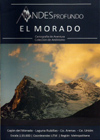
El
Morado
30
x 42 / 15 x 12 cms.
Ch$
7.500 |
Trail to Mirador del Morado and ascent routes of the mountains Morado, Morado Sur, Unión, Chacaya, Arenas and Punta Ventana. Baños Morales, Lakes Morales, Morado and Rubillas. Campsites and climbing areas.
Shows coordinates of important points, distances on trails.
Mountaineering, Cross-country skiing, 1:35,000, UTM coordinates, equidistance contour lines 25 m.
|
|
Cerro
Marmolejo
30
x 42 / 15 x 12 cms.
Ch$
8.500 |
Normal Route from Marmolejo base camp, Salinillas Route from Río Yeso, Termas del Plomo. Route to Portezuelo Piuquenes. Campsites.
Shows coordinates of important points, distances on trails.
Mountaineering, Cross-country skiing, 1:35,000, UTM coordinates, equidistance contour lines 25 m.
|
|
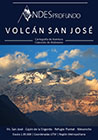
Volcán
San José
30
x 42 / 15 x 12 cms.
Ch$
7.500 |
Normal route to San José volcano, Refugio Plantat and campsites. Routes from Mesoncito to Morro Escondido and Cerro Mohai. Cajón de la Engorda to Cerro Andrade; Valle de Colina with Cajón de Nieves Negras and Cerro Puntiagudo, Baños de Colina.
Shows coordinates of important points, distances on trails.
Mountaineering, Cross-country skiing, 1:35,000, UTM coordinates, equidistance contour lines 25 m.
|
|
Río
Los Cipreses
Spanish, English, German
75
x 70 / 18 x 13 cms.
on stone paper
Ch$
7.500 |
Side
1: All the national reserve Río Los Cipreses
with a lot of hiking trails and activity symbols.
Trekking, 1:100.000
Side 2: Details from El Manzanal to the area of Placeta
de Maitenes.
Trekking, 1:25.000, coordinates Lat/Long y UTM.
|
|
Nº
5 Maule, Biobío y Araucanía
68
x 100 / 27 x 15 cms.
Ch$
6.000 |
Side 1: From Rengo and Pichilemu to Bulnes and Talcahuano.
Side
2: From Bulnes and Talcahuano to Lago Caburgua.
Road
Map, 1:400.000
|
|
Condor
Circuit
Spanish, English, German
70
x 91 / 17,5 x 13 cms.
on stone paper
Ch$
7.500 |
Side
1: National Reserves Radal Siete Tazas and Altos de
Lircay. Covers from Parque Inglés and Vilches
Alto to the volcanoes Descabezado Grande and Quizapu;
wide net of trails and paths that connect the region.
Scale 1:50.000, coordinates in Lat/Long (one-minute-grid)
Side 2: Detail map of the area Vilches Alto - Enladrillado
1:25.000; detail map of the area Siete Tazas - Parque
Inglés 1:25.000.
|
|
Melado
Vn. San Pedro
Español / English
69 x 75 / 17,5 x 13 cms.
Ch$
5.500 |
Side
1: Area south of Maule river, a little known region
for trekking and horseriding. Covers the Melado valley
and the vulcanoes San Pedro and San Pablo. with contour
lines, trekking routes, hot springs, shelters, hostels
and campsites.
Scale 1:50.000, coordenates in Lat/Long and UTM.
Side 2: Map of downtown talca plus a list of recommended
hostels and tourist services
|
|
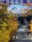
Nevados
de Chillán
Spanish, English, German
70
x 75 / 17,5 x 13 cms.
Ch$
5.500 |
Side
1: From Recinto to the mountain range Nevados de Chillán
and National Reserve Ñuble (Los Peucos, Valle
Hermoso); valleys of Las Trancas, Shangri-La and Aguas
Calientes
1:50.000, coordinates in Lat/Long (one-minute-grid)
Side 2: Details of Las Trancas-area (Scale 1:12.500);
listing of touristic adresses, native flora.
|
| |
|
|
|
Check
also the maps on demand by Aoneker/Pixmap >  |
| |
|