|
|
| Aoneker
/ PixMap. |
A
serie of maps made by a group of cartographers and mountaineers.
They cover different national parks and mountains in both
Argentina and Chile. Excellent geographic information, contour
lines and relief, with grid and coordinates in UTM and Long./Lat.
(WGS84) plus magnetic declination. They are very good for
trekking purpouses and can be used along with a GPS. They
show regular paths and also some less used, but not all
maps include campsites and times for walks.
Some maps were published under the branch PixMap in a different
layout, but with the same cartographic standards. New maps
are now published with both names.
This
company offers the possibility to buy "maps on demand"
of areas that are no of massive interest and don't justify
a commercial printing, or if a previous edition is sold
out. They are printed by units and are about 50% more expensive
than a normal edition. Of some of these maps we have a few
copies in stock, others we can get within 2-4 weeks. At
the bottom of this page we put a list with some titles.
Please ask us for more details or other possible areas.
|
| |
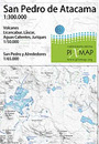
San
Pedro de Atacama
(Chile)
72
x 55 / 19,5 x 12,5 cms.
Ch$
7.000 |
Side
1: Surroundings of San Pedro de Atacama, from Chiu Chiu
and Laguna Colorada (Bolivia) to Paso de Sico, including
Geisers del Tatio, Valle de la Luna, Salar de Atacama
and the lagoons of Tara, Miscanti and Miñiques.
Road map, orientation, 1:300.000
Side 2: Inserts with details of Quebrada San Pedro,
Lascar volcano and Licancabur volcano.
Trekking, 1:65.000 y 1:50.000

|
| |
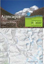
Aconcagua
(Argentina)
72
x 55 / 19,5 x 12,5 cms.
Ch$
6.000 |
Side
1: Mount Aconcagua main massive, shows the different
ascent routes - Mountaineering; 1:60.000, contour interval
is 25 m
Side 2: The whole Cordón del Plata, in the surroundings
of the ski center Vallecitos, a popular spot to get
aclimate before climbing Aconcagua. With the routes
to the hills Agustín Álvarez, Rincón,
Vallecitos, Negro and Plata (5930 msnm).
Mountaineering; 1:50.000, contour interval is 25 m
|
|
Aconcagua
1:25.000 -
Parque Provincial Aconcagua
(Argentina)
42,5
x 60 / 21,5 x 12,5 cms.
Ch$
6.000 |
Lado
1: Macizo central del Cerro Aconcagua, con diferentes
rutas de ascenso. Río Horcones Superior, Plaza
de Mulas; Campamentos y refugios.
Montañismo 1:25.000, equidistancia curvas nivel
25 m
Lado 2: Parque Provincial Aconcagua, entre Punta de
Vacas, Las Cuevas y el Límite Internacional.
Senderismo, 1:100.000, equidistancia curvas nivel 25
m
 |
| |
Paloma
/ El Plomo
(Chile)
60
x 42,5 / 21,5 x 12,5 cms.
Special
map, printed on demand -
Ch$ 7.000
|
Routes
to hills Paloma, Plomo and Leonera; Farellones, La Parva
and Valle Nevado, Yerba Loca Natural Sanctuary
Mountaineering,
Trekking; 1:50.000, contour interval is 25 m
|
| |
Villarrica
Traverse
Pucón - Volcanes Villarrica y Quetrupillán
(Chile)
60
x 42,5 / 21,5 x 12,5 cms.
Ch$
8.000
|
Side 1: Surrounding of Villlarica volcano, from Pucón
to Termas Vergara and Palguín valley. Trails
Challupén, Los Cráteres, Pichillancahue/Nevados,
Valle Turbio, Ruta Volcán and many more.
Side 2: Quetrupillán volcano from Palguín
Alto to Puesco and Curarrehue. Trails Venados, Avutarda,
Huililco, Quinquilil, ascent route to Quetrupillán,
etc.
Mountaineering, Trekking; 1:50.000, contour interval
is 25 m
UTM coordinates every 2500 meters.
|
| |
Ruta
de los 7 Lagos
San Martín al Vn. Lanín
(Argentina)
60
x 42,5 / 21,5 x 12,5 cms.
Ch$
7.000
|
Side 1: From lake Lacar to Nahuelhuapi, San Martín
de los Andes, Villa Angostura, Villa and lake Truful,
Confluencia
Side 2: From Lanin volcano to San Martín de los
Andes with the lakes Tromen, Paimún, Huechulafquén,
Currhué, Lolog and Lacar.
Shows several trekking routes.
Orientation,
Trekking 1:150.000, contour interval is 50 m
|
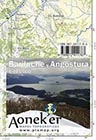 |
S.
C. de Bariloche y Villa La Angostura
(Argentina)
42,5
x 60 / 21,5 x 12,5 cms.
Ch$
7.000 |
Side 1: From lake Nahuel Huapi (Arm Blest) until lake
Guillermo, all of the central part of the NP Nahuel
Huapi with Mount Tronador, hills Negro and Catedral
with its trails, refuges, campsites and hostels.
Side 2: Northern part of lake Nahuel Huapi until the
lakes Traful and Espejo, from the Puyehue Pass (a.k.a
Samoré) until the confluence of the rivers Traful
and Cuyín Manzano. Shows many hotels and campsites
and also some trails.
General orientation, Trekking; 1:125.000
|
| |
San
Carlos de Bariloche
(Argentina)
42,5
x 60 / 21,5 x 12,5 cms.
Ch$
6.000 |
Bariloche to Colonia Suiza with the hills Catedral,
López, Negro and Cuernos del Diablo; trails to
the Traverse Nahuel Huapi from Villa Catedral - Refugio
Jakob - Refugio Laguna Negra (Segre) - Colonia Suiza
Trekking; 1:50.000, contour interval is 25 m
|
| |
Monte
Tronador
Paso de las Nubes
(Argentina)
42,5
x 60 / 21,5 x 12,5 cms.
Ch$
6.000 |
Mount Tronador with the ascent routes, trail "Paso
de las Nubes" between Pampa Linda and Puerto Frías;
plus the area of the hills Bonete, Capitán, Constitución
and Parque; arm Tristeza from the Lake Nahuelhuapi,
lagoons Frey, Ilón and Azul
Trekking;
1:50.000, contour interval is 25 m
|
| |
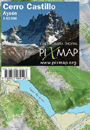
Cerro
Castillo
Aysén
(Chile)
60
x 42,5 / 21,5 x 12,5 cms.
Ch$
7.000 |
Side 1: Area north of Cerro Castillo until the lakes
Azul, Paloma and Monreal. Entry trails from Monreal
and Horquetas Grande.
Side 2: From Cerro Castillo mountains to Río
Ibáñez valley, with campsites El Bosque,
La Tetera and Neozelandés..
Trekking 1:50.000, contour interval is 25 m
|
| |
Chaltén
y Campos de Hielo Sur
Lagos del Desierto y O'Higgins
(Argentina/Chile)
42,5
x 60 / 21,5 x 12,5 cms.
Ch$
7.000 |
Side 1: From Lago del Desierto to lake and glacier Viedma
with roads, trails and navigation routes, campsites
and refuges.
General orientation 1:125.000, contour interval is 50
m
Side 2: Shows the area south of Lago O'Higgins, especially
the adventure route that leads from Candelario Mansilla,
passing the Lago del Desierto, to reach the road to
El Chaltén.
Trekking 1:80.000, contour interval is 25 m
|
| |
Fitz
Roy & Cerro Torre
Glaciar Viedma - Paso del Viento - Paso Huemul
(Argentina)
42,5
x 60 / 21,5 x 12,5 cms.
Ch$
7.000 |
Side 1: From the town of Chaltén to the Southern
Icefield with the hills Marconi, Fitz Roy, Torre and
Grande; trails to the lagoons Torre, de los Tres and
lake Eléctrico, with all the campsites and refuges.
Side 2: Covers the area between lake and glacier Viedma,
shows the trekking circuit around Cerro Huemul through
Paso del Viento and Paso Huemul.
Trekking 1:50.000, contour interval is 25 m
|
| |
Ushuaia
y Alrededores
(Argentina)
42,5
x 60 / 21,5 x 12,5 cms.
Ch$
7.000 |
Side 1: National Park Tierra del Fuego, between the Beagle Channel,
Lake Fagnano, International Border and Lake Escondido;
trails in the area of Lapataia, along the Beagle Channel
and Lake Fagnano
Lado 2: Area of the lakes Fagnano, Yehuin and Chepelmuth;
Reserva Provincial "Corazón de la Isla"
Trekking;
1:100.000, contour interval is 25 m
|
|
| |
|
| |
|