|
|
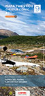
| Patagonian
Chile - South from Puerto Montt: |
|
Nº
6 Villarrica, Llanquihue y Chiloé
68
x 100 / 27 x 15 cms.
Ch$
6.000 |
Side
1: From Lago Villarrica to Puerto Montt.
Side
2: From Maullín and Puelo to La Junta.
Road
Map, 1:400.000
 |
|
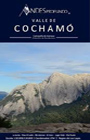
Cochamó-Puelo
Español, english, deutsch
68
x 77 / 17,5 x 13 cms.
on stone paper
Ch$
7.500 |
Side
1: Map of the valleys Cochamó, Manso and lower
Puelo, an area famous for the best rock climbing in
La Junta and many rivers for fishermen. Shows trails
(distances in km), lodging, campings, etc
Scale 1:75.000, UTM and Lat/Long coordinates
Lado 2: Detail maps of La Junta (with climning routes,
trails and tourist facilities) and Parque Tagua Tagua
with trails (distances in km and hours), refuge and
attractions.
Scale 1:25.000, UTM and Lat/Long coordinates |
|
Valle
de Cochamó
Paso El León
60
x 50 / 22 x 14 cms.
Ch$
11.900 |
Side 1: Cochamó valley from El Morro to the areas of La Junta, El Arco and lake Vidal Gormaz up to Paso El León (Río Manso), with trails, refuges and campsites and a table with distances.
Side 2: Río Manso valley from Torrentoso to its confluence with the Río Puelo. Enlarged insert 1:30,000 of the La Junta area with the routes to the climbing walls. Arcoiris, Capicua, Trinidad, Quick Dick and Amfiteatro hills. Shows coordinates of important points.
Hiking, Rock climbing, 1:50,000, UTM coordinates, equidistance contour lines 25 m
|
|
Volcán
Yates
30
x 42 / 15 x 12 cms.
Ch$
7.500 |
Yates volcano with ascent route from the northeast, Puente Llaguepe. Camps 1 and 2. Cordillera Pululil.
Shows coordinates of important points, distances on trails
Mountaineering, Cross-country skiing, 1:28,000, UTM coordinates, equidistance contour lines 25 m.
|
|
Nº
7 Carretera Austral
68
x 100 / 27 x 15 cms.
Ch$
6.000 |
Side
1: FromLa Junta to Puerto Ibañez / Lago General
Carrera.
Side
2: From Chile Chico / Lago General Carrera to Villa
O'Higgins.
Road
Map, 1:400.000
|
|
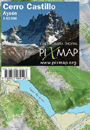
Cerro
Castillo
Aysén
(Chile)
60
x 42,5 / 21,5 x 12,5 cms.
Ch$
7.000 |
Side 1: Area north of Cerro Castillo until the lakes
Azul, Paloma and Monreal. Entry trails from Monreal
and Horquetas Grande.
Side 2: From Cerro Castillo mountains to Río
Ibáñez valley, with campsites El Bosque,
La Tetera and Neozelandés..
Trekking 1:50.000, contour interval is 25 m
|
|
Parque
Nacional
Cerro Castillo
68
x 48/ 16 x 12. cms.
Ch$
7.500 |
It shows the Cerro Castillo National Park from Lake Monreal to Villa Cerro Castillo with all its routes and campsites.
Includes the trail to Lago Tamango south of the Río Ibáñez.
Hiking, Mountaineering, 1:50,000, UTM coordinates, equidistance contour lines 25 m
|
|
Cerro Castillo
30
x 42 / 15 x 12 cms.
Ch$
8.500 |
Central area of the Cordillera Castillo with the mountains Castillo, Peñón, Palo and Puntudo. Trails to the lakes Duff, Castillo and others unnamed. Ascent routes to the mountains Castillo, Puntudo, La Montura and Punta Duff. Campsites Neozelandés, Los Porteadores, La Tetera and El Bosque.
Shows coordinates of important points, distances on trails
Mountaineering, Trekking, 1:25,000, UTM coordinates, equidistance contour lines 25 m.
|
|
Parque Nacional Patagonia
81
x 65 / 21 x 14 cms.
Ch$
8.500 |
It covers the area of the old Jenimeini and Tamango reserves that together with a private park form the new Patagonia National Park. It shows the trails Travesía Aviles, Lagunas Altas, Los Valles, Mirador del Polaco and Lago Gutierrez Route. Campsites Valle Hermoso, El Silencio, Westwind; shelters and posts.
Shows coordinates of important points, distances on trails.
Hiking, 1:50,000, UTM coordinates, equidistance contour lines 25 m.
|
|
Monte
San Lorenzo
30
x 42 / 15 x 12 cms.
Ch$
7.500 |
Shows the normal route to the main peak, Refugio Rohrer, Paso El Comedor, Brecha de Cornisa, the camps 1 and 2; Fundo San Lorenzo, house of Luis Soto, Cordón Cochrane, Cordón Feruglio. Cerro Ortúzar. Lake and glacier Calluqueo and the access road X-801.
Shows coordinates of important points, distances on trails
Mountaineering, 1:36,000, UTM coordinates, equidistance contour lines 25 m.
|
|
Nº
8 Campos de Hielo y
Torres del Paine
68
x 100 / 27 x 15 cms.
Ch$
6.000 |
Side
1: From Lago O'Higgins to Torres del Paine and Cerro
Castillo.
Road Map, 1:400.000
Side
2: From Cerro Castillo to Seno Almirantazgo
Road Map, 1:550.000
|
|
Chaltén
y Campos de Hielo Sur
Lagos del Desierto y O'Higgins
(Argentina/Chile)
42,5
x 60 / 21,5 x 12,5 cms.
Ch$
7.000 |
Side 1: From Lago del Desierto to lake and glacier Viedma
with roads, trails and navigation routes, campsites
and refuges.
General orientation 1:125.000, contour interval is 50
m
Side 2: Shows the area south of Lago O'Higgins, especially
the adventure route that leads from Candelario Mansilla,
passing the Lago del Desierto, to reach the road to
El Chaltén.
Trekking 1:80.000, contour interval is 25 m
|
|
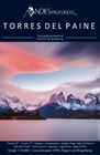
Torres
del Paine
Spanish, English, German
70
x 74 / 17,5 x 13 cms.
on stone paper
Ch$
7.500 |
Side 1: Central area of the park with Paine massif and
the hikes "Paine Circuit" and "W",
trails with distances in kms, hotels, huts, campings,
etc.
Scale 1:50.000, coordinates in Lat/Long and UTM.
Side 2: More extense park area including Lago Pingo
and Pueblito Serrano, scale 1:100.000; map with access
routes from Puerto Natales; city map Puerto Natales
|
|
Torres
del Paine
81
x 65 / 21 x 14 cms.
Ch$
8.500 |
Side 1: From Laguna Azul to Hotel Lago Grey.
Side 2: From the lakes Grey y Pingo to the South Patagonian Icefield.
Trails "W-Traverse" and "O-Circuit", to the Pingo valley, lakes Verde and Azul, to Base Torres and Valle del Silencio. Routes Cerro Zapata, Paso Oggioni, Cerro Paine and Valle Bander. Shelters, campsites and hotels.
Shows coordinates of important points, distances on trails.
Hiking, 1:50,000, UTM coordinates, equidistance contour lines 25 m.
|
|
Nº
9 Tierra del Fuego
Antártica Chilena
68
x 100 / 27 x 15 cms.
Ch$
6.000 |
Side
1: From Río Grande (Argentina) to Islas Diego
Ramírez
Road Map, 1:550.000
Side
2: All Antartica at scale 1:5.000.000, details of the
South Shetland Islands
|
| |
|
|
|
Check
also the maps on demand by Aoneker/Pixmap >  |
| |
|